About Us

The Company
Our Equipment
The Company
Based in New Orleans, LA, our mission is to provide a range of high quality drone-based services to customers in Louisiana, Mississippi, and the greater Gulf Coast region.
We currently specialize in drone photogrammetry/mapping, photography, videography, and visual inspection services, but are always looking for new opportunities...
Skypoint is actively seeking customers interested in a variety of service areas and imaging technologies. Please feel free to reach out and let us know how we can help you.

Our Pilot
Our Equipment
The Company
Dillion Asher - FAA Part 107 sUAS certified (#4403311), FAA Student Pilot certificate (#4367333), flight experience w/ DJI Matrice and Phantom on photogrammetry survey projects.
B.S. and M.S. Geoscience, M.A. International Development, professional background in Coastal & Environmental Geoscience, Oil/Gas/Energy and Minerals Exploration.
Interests include photogrammetry, photography, videography, thermography, LiDAR, and multi-spectral imaging within Coastal Geosciences, Environmental, Search & Rescue, Infrastructure, and Agricultural service areas.

Our Equipment
Our Equipment
Our Equipment
Drone: DJI Phantom 4 Pro v2.0 w/ gimbal-stabilized 20MP camera; customizable photo/video imaging and flight modes.
Ground Control Hardware: Emlid Reach RS+
Software: Pix4D (Measure Ground Control)
Transportation: 4x4 SUV
Insurance: $1 million Property/Bodily Injury
On-demand Equipment: need to deploy a thermal IR or multispectral camera? We can help. Skypoint is always looking for opportunities to expand to new service areas!
We can readily acquire and incorporate new drone systems and imaging technologies to suit your needs- let us know what you need.
services & pricing
Floodplain & Coastal Elevation Mapping - Wildlife & Habitat Monitoring - Roof & Infrastructure Inspection - Insurance Claim Validation - Commercial & Residential Real Estate - Construction Site Monitoring - Events & Promotional Material

Photography
- Up to 30 Standard and 15 HDR-quality photos
- Customer-approved shot list
- Image filtering and processing
- Digital copies of raw and edited media**
**via Google Drive or customer flash drive
Videography
- Up to 3 minutes edited video (+$100 each additional 1.5 min)
- Customer-approved shot list
- 4k/Cinema 4k resolution @24/30/48/60fps options
- music and/or voiceover options
- Digital copies of raw and edited media**
**via Google Drive or customer flash drive

Photo + video package
- Up to 30 Standard and 15 HDR-quality photos
- Up to 3 minutes edited video (+$100 each additional 1.5 min)
- Standard photo and video features and options- shot list, filtering, processing, sound, video formats, digital media copies**
**via Google Drive or customer flash drive

Photogrammetry
Priced by project location, size & deliverables⁺, standard pilot and mileage rates may apply*; products and services include:
- 2D orthomosaic maps
- 3D models
- Digital Surface Models (DSMs)
- Ground control and geo-referencing
- Pix4D data analysis reports
- Project documentation in customer-approved formats
- Digital copies of all media**

visual inspection
Priced by project location, size & deliverables⁺, standard pilot and mileage rates may apply*; products and services include:
- One-time or recurring flights
- Photos (standard or HDR)
- Videos (unedited or edited)
- On-site video live stream
- 2D Maps & 3D Models, $250 and up
- Inspection documentation in customer-approved formats
- Digital copies of all media**

thermography
On-demand thermal imaging services in the following areas:
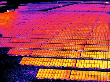
- Wind & Solar PV
- Oil/Gas/Petrochemical
- Electrical Infrastructure
- Search & Rescue
- Wildlife Monitoring
Get in touch with us at Skypoint Imagery to discuss your thermography requirements!
* $60/hr for pilot on-site for work exceeding 2 hours, Mileage = outside Orleans Parish @2022 IRS business rate of $0.585; ** via Google Drive -or- customer flash drive; ⁺ additional information required for pricing
Instagram
Video
Hyalite Reservoir, Gallatin County, Montana
Portfolio


Contact Us
We'd love to hear from you!
Have a question about the services we provide? Send us the details on the type of project you're looking to hire for, and we'll be happy to get back to you with a free quote and information.
Reviews
Copyright © 2020 Skypoint Aerial Imagery LLC - 5435 Glenellen Drive, Unit 18, Bozeman MT 59718
All Rights Reserved.
Powered by GoDaddy
This website uses cookies.
We use cookies to analyze website traffic and optimize your website experience. By accepting our use of cookies, your data will be aggregated with all other user data.
